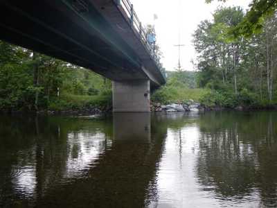
North Fork Snoqualmie Bridge Protection and Flood Mitigation
The existing 428th Ave. SE bridge over the North Fork Snoqualmie River is at risk of damage by scour and erosion and the roads leading to the bridge are frequently overtopped by flood water. WSE was retained to complete hydraulic modeling to assess bridge scour and erosion risk as well as evaluate alternatives to reduce road overtopping in-order to reduce isolation of over 50 homes.
Role / Sevices: WSE developed design discharge estimates by scaling flow hydrographs collected at USGS gages on the North and Middle Forks of the Snoqualmie and used them as inputs to a HEC-RAS 2D model of the project reach which was calibrated it to recent flood events. WSE used the model to assess current bridge scour and erosion risk and five different road raising / bridge and culvert improvement alternatives to reduce road overtopping to improve access to multiple neighborhoods during floods. The model was used to determine if alternatives comply with the County's "Zero-Rise" floodplain regulations.
Outcome: WSE used the HEC-RAS 2D model to demonstrate that the initial road improvement alternatives identified by the project team did not meet the "Zero-Rise" criteria. WSE then used the model to refine the alternatives to inform the County as to what would be needed to bring them into compliance. The County is using this information to evaluate and compare alternatives.
