Expertise and innovation.
WSE offers specialized and unique services to help our clients interact successfully with rivers and communities. Our team has 130+ cumulative years of experience providing services to government agencies, municipalities, utilities, environmental and engineering consulting firms, corporations and private citizens.
Our focus is on technically and logistically challenging projects in rivers, streams, floodplains, lakes, estuaries, and coastal environments. Successful completion of these projects often requires sophisticated tools and special skills such as those listed below

Hydrologic Modeling
Continuous simulation or event based hydrologic modeling with HSPF, HEC-HMS, HEC-1, KCRTS, SWMM, WWHM, DHSVM or other modeling software for basin planning, dam safety or reservoir operation studies, Capital Improvement Plan (CIP) project evaluation, land development review, water rights analysis, climate change assessment or similar projects
Hydraulic Modeling
Steady state or unsteady 1-dimensional or 2-dimensional hydraulic modeling using HEC-RAS, SRH-2D, FEQ, FLO-2D, River2D, RiverFlow2D Plus, FESWMS, SWMM EXTRAN or other modeling programs for flood hazard reduction planning and design, restoration design, floodplain mapping and analysis, bridge scour studies, levee assessments, sediment transport analyses, dam breach routing, stormwater system design, culvert replacements or similar projects

GIS Analyses
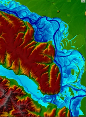
Hydrologic and hydraulic model input development, model output post-processing, flood inundation map preparation, impact or benefit analysis, report figure creation, design drawing revision and similar product development using ESRI ArcGIS software. WSE also maintains proficiency with other pre- and post-processing modeling tools that interface with the ArcGIS software, including SMS, HEC-GeoRAS, RAS Mapper and AutoCAD
Field Services
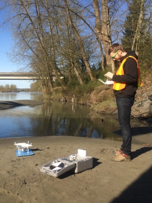
Implementation, operation and maintenance of remote gaging networks, streamflow and velocity measurements, sediment sampling and elevation surveys. WSE also owns and operates our own DJI Phantom UAV (“drone”), which provides the ability to capture unique photographic perspectives and collect aerial survey to help us better understand our project sites. WSE uses drone-collected data to produce study level topographic and bathymetric surfaces, monitoring geomorphic change and sediment deposition and transport characteristics and assessing infrastructure and habitat conditions.
WSE also offers the following specialty services:
FEMA Map Revision Requests
Preparation of Letter of Map Revision (LOMR) and Conditional Letter of Map Revision (CLOMR) requests to FEMA for levee certifications, floodplain re-delineations, floodway modifications. WSE also prepares technical appeals to FEMA mapping studies. Our team is current with the latest FEMA regulations, including recent changes regarding levees and endangered species.
Forensic Investigations
Expert technical assistance for mediation, arbitration or litigation of water resource issues including flooding problems, stormwater management, erosion hazards, sedimentation problems, water rights issues and river navigability assessments
Risk-Based Analysis
Risk analyses using USACE procedures for flood control projects, such as dams and levees, and risk based evaluations for dam safety using the Washington Department of Ecology Dam Safety guidelines
When you work with WSE, we will use our intimate knowledge of all available tools to develop a custom, comprehensive approach that achieves your goals.
View our services or contact us to see how we can help with your river challenge.