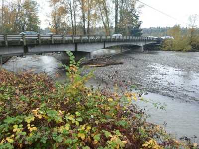
White River Countyline Levee Setback Conditional Letter of Map Revision
WSE was retained by King County to develop an updated branched flow one-dimensional (1D) HEC-RAS hydraulic model of the White River from East Valley Highway (A St SE) in Auburn to the Stewart Road bridge (8th St E) in Sumner. The purpose of the model was to evaluate a proposed levee setback project within this reach, and to use the model to submit a revision to the FEMA effective maps through a Conditional Letter of Map Revision (CLOMR). Although a two-dimensional (2D) model was available from a recent King County sedimentation study, HEC-RAS is the preferred software by FEMA for mapping revisions and also better simulates bridge hydraulics than the County's 2D model.
Role / Services: WSE completed development of a branched flow hydraulic model, using the one-dimensional (1D) HEC-RAS software. The model is based upon floodplain LiDAR data from 2011 merged with channel bathymetry surveyed in 2012, including an updated survey of the Stewart Road bridge cross-section and structure. Modeling inputs (mainly roughness and weir coefficients) were adjusted to "calibrate" the model to two-dimensional 2D results available from a recent County sedimentation study. The 1D HEC-RAS model, using multiple branches and lateral connections for flow splits, was able to replicate the 2D results with good precision. Multiple simulations were completed for the 100-year design flood event. WSE has maintained close coordination with the client, including several meetings, to discuss the modeling analysis and review results.
Outcome: WSE used the model to evaluate various model scenarios required for updating the Flood Insurance Rate Maps via the CLOMR process, including a floodway analysis. WSE used GIS to prepare mapping products necessary to submit the CLOMR to FEMA.
