Naneum/Wilson/Cherry Watershed Assessment
The creeks that enter the Kittitas Valley near Ellensburg form a naturally complex system. Over 100 years of manipulation for irrigation, including canals, ditches, diversions, and returns, has increased the hydraulic complexity of the valley. The complexity and summer low flows in the channels make it extremely difficult for fish to reach the upper watershed, which was historically steelhead habitat. The complexity also makes flood routing difficult to predict and manage. The goal of this project is to gain a better understanding of both the low-flow and high-flow hydraulics and morphology of this complex system, as the first phase of a larger project to improve fish habitat and manage flooding impacts.
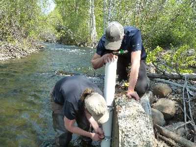
Role / Services: WSE installed 10 pressure transducers and 12 crest gages throughout the project area to assess both low-flow and high-flow conditions at strategic locations to provide a better picture of how water flows through the area, where the peak flows are concentrated, and where low flows and temperatures preclude fish use. 2-D hydraulic modeling is also being used to predict flood flow patterns, which are complicated by the interconnections between the various stream channels via natural overflow or irrigation ditches and canals.
Outcome: This phase of the project will be completed in June 2017, and will identify high priority reaches for future habitat, water supply, and flood reduction projects.
