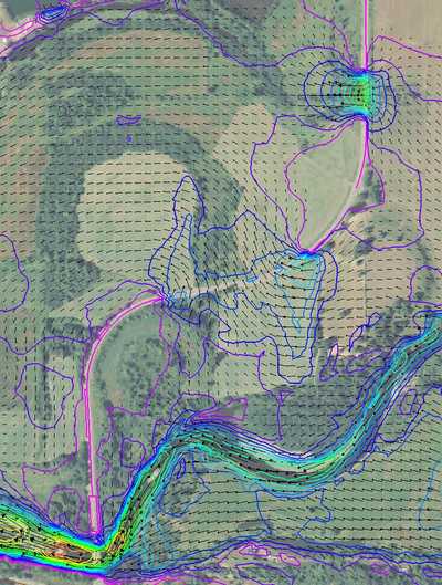
Elma to Porter Flood Mitigation Project
WSE was retained by Grays Harbor County to evaluate options for improving Wakefield Road south of Elma to reduce upstream flood impacts caused by flood flows from the lower Chehalis River. The study included evaluating how Wakefield Road affects existing flooding in surrounding areas and how conditions would change with enlarged overflow bridges along the road.
Role/Services: WSE created a terrain surface consisting of bed contours from in-channel bathymetric surveys merged with floodplain LiDAR. This surface was used in the development a two-dimensional (2D) SRH-2D model along the 11.5-mile study reach of the project, to accurately represent the large floodplain of the Chehalis River including a complex network of large side and remnant channels that carry overbank flows. The model allowed for analysis of the complex hydraulic conditions on the floodplain near overflow bridges, simulation of super-elevation of flood levels along the outside edge of large meander bends, and simulation of detailed velocity patterns. Comparisons of flood extents, depths, and velocities between existing and proposed conditions could easily be made and visually conveyed using the model.
Outcome: Results indicated that longer overflow bridges (larger openings) on Wakefield Road would provide insignificant flood reduction benefits and was cause enough to recommend no further action be taken on this project at the time. WSE was also asked to evaluate several other potential local flood damage reduction projects in the area including a new overflow bridge on Dunlap Road, channel dredging, and floodplain conveyance improvements, all of which could be analyzed with the 2D model.
